
Thomasville ZIP Code Directory Coverage
Two ZIP codes appear in the Thomasville mailing-area research, but they do different work. Standard street delivery and nearby Davidson County mailing areas use 27360. The 27361 entry is associated with Thomasville Post Office PO Box service. Neither number is a city-limit line, a parcel ID, or a list of people connected to every address within its postal area. Use the full address with the postal tool first, then compare the result with Davidson County's ZIP and municipality layers.
| ZIP | Areas Covered | Post Office | Notes |
|---|---|---|---|
| 27360 | Thomasville street delivery and surrounding Davidson County mailing areas | Thomasville postal service | Its mailing line can extend outside the Thomasville municipal boundary. |
| 27361 | Thomasville PO Box service | Thomasville Post Office | A PO Box ZIP is a mailing route, not a parcel location or a residential situs address. |
USPS label material identifies the Thomasville range as 27360-27361. Treat that range as postal service information. The county's street-labeled map is the better local visual for seeing ZIP polygons alongside roads, municipalities, and the OUTSIDE areas of Davidson County.
Thomasville Postal Checks
The USPS ZIP Lookup offers address-to-ZIP, city/state-to-ZIP, and ZIP-to-city tasks. Its warning is important: a returned ZIP does not confirm that a person or company is at the address. Postal standardization answers what to put on a mailing line. It should be kept separate from the question of where a parcel sits or which public record office holds a property or election record.
The local comparison begins with the Davidson County street-labeled ZIP map, created January 29, 2026. It displays ZIP polygons and roads across Thomasville, High Point, Lexington, Midway, Wallburg, Denton, and OUTSIDE areas. That is why a Thomasville mailing city can appear on a county parcel outside the city line.
The Davidson County WebGIS viewer provides the parcel-level follow-up through address points, roads, ZIP layers, neighborhoods, and municipalities.
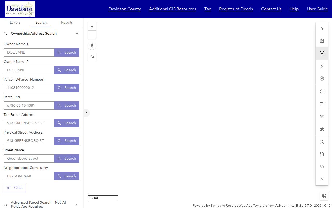
Use the map result as a geographic handoff. Capture the parcel or PIN and then consult the tax or deed system for the separate property record, keeping the map date and visible layers with the result.
Note: A postal city is for delivery; a municipality layer is for jurisdiction; a parcel key is for property research.
Thomasville ZIP Research Steps
There is no single ZIP-wide resident roll in the Davidson systems examined. The tax forms do not expose a ZIP input, and the public voter lookup uses county and voter-status criteria rather than ZIP. The practical method is therefore ZIP to street or parcel, then parcel to the relevant public record. A Thomasville ZIP code directory is most helpful when it sets the geographic starting point without promising a name list that the official portals do not provide.
- Use USPS with the complete street address to obtain a standardized mailing city, state, and ZIP result. Save whether the search was address-to-ZIP, ZIP-to-city, or city/state-to-ZIP.
- Open WebGIS, turn on the ZIP and municipality context, search the physical address or street, and capture the mapped parcel, PIN, address point, and city or OUTSIDE layer.
- Query the Davidson Tax Real Estate Search by the PIN or property address. Record the situs address, mailing address, tax year, and assessment fields separately.
- Use the parcel's legal description, deed reference, or record party in Davidson Deeds for recorded real-estate research. The online index covers 1984 to current; older work belongs with the Register, library, or Archives.
- For a public election question, search the North Carolina voter lookup by its actual form fields or contact the Davidson County Board of Elections for a defined request. Do not substitute the ZIP for the portal's county and status criteria.
When the question becomes which records can be followed along one named road, use the Thomasville street directory for the address-by-address sequence rather than trying to turn the ZIP polygon into a complete list.
Thomasville ZIP Map Search Fields
WebGIS is ZIP-capable because its map includes ZIP layers and can work from an address point or current extent. It does not make ZIP a universal record key. Use a ZIP polygon to frame the search, then use the physical address, street name, parcel number, or PIN to locate a specific record. The interactive viewer can also bring neighborhood, legal-land, value, sale, and deed-date filters into the same spatial check.
| WebGIS field or tool | Type | ZIP research use |
|---|---|---|
| ZIP Codes layer | Map layer | Frame the postal geography around a Thomasville address. |
| Tax Parcel Address or Physical Street Address | Text | Locate the mapped property after postal standardization. |
| Street Name or Neighborhood Community | Text or selector | Browse a defined area within the visible ZIP context. |
| Parcel ID, Parcel Number, or PIN | Text | Carry a mapped property to the Tax and Deeds systems. |
| Municipality and current map extent | Layer and map filter | Test whether a mailing area crosses Thomasville's city line. |
| Select, Identify, and CSV export | Map tools | Preserve a narrow spatial result with the visible context. |
The GIS legend also lists roads, polling places, schools, fire stations, historic districts, tax neighborhoods, and E-911 context. These can help route an address question to the right custodian, but they do not provide an official attendance determination or a household roster.
Note: The current ZIP layer helps locate geography, but only the postal result answers mail-delivery formatting.
Thomasville ZIP Boundaries
Thomasville's municipal limits and postal coverage do not match perfectly. The Davidson map visibly distinguishes Thomasville from OUTSIDE areas, even where the address may carry a 27360 Thomasville mailing line. A property request should therefore retain three pieces of information: the USPS delivery presentation, the GIS municipality layer, and the parcel's physical location. This avoids sending a city question to the wrong office or treating a mailing line as proof of city jurisdiction.
City-limit check. Before filing an address request, compare the USPS result with the WebGIS municipality layer and parcel location. A Thomasville ZIP alone does not establish that the property lies inside city limits.
County road naming and address authority add another reason to verify the jurisdiction. Davidson County's 911 address program created a uniform framework, while the official research did not locate a complete current annexation-by-year table for every Thomasville street. Ask city planning or county addressing for an address-routing question that the online map does not resolve.
Thomasville Postal Terms
Postal labels need plain definitions before they are used in record research. A ZIP result may be precise enough for delivery and still be too broad for a parcel question. Likewise, a more detailed postal code does not replace the legal description, parcel PIN, or physical-address evidence held by the county.
- ZIP
- A postal sorting code used to route mail. It is not a municipal boundary or resident record.
- ZIP+4
- An added four digits that refine delivery routing within a ZIP. It does not identify a parcel owner or household.
- PO Box ZIP
- A postal code used for box service. It provides a mailing route, not a street-level property location.
- Unique ZIP
- A ZIP assigned for a particular delivery arrangement or institution. None was established as a Thomasville parcel-research key in the sources reviewed.
- Carrier route
- A mail-delivery grouping that helps USPS distribution. It is not a boundary survey or a public list of people.
Note: Preserve the full input address and the exact USPS output instead of storing only a ZIP beside a person's name.
Thomasville ZIP Evidence
A careful ZIP result has a small evidence trail. Record how the postal tool was queried, then identify whether the GIS map actually located a parcel. If property evidence is needed, keep the tax and deed responses separate. That small record of the search prevents a delivery code from being reused as a claim about a person's current address.
| Postal input and output | Full address used, USPS standardized result, ZIP, delivery-city line, and lookup mode. |
|---|---|
| Map context | WebGIS parcel or PIN, ZIP layer, municipality layer, visible extent, and date. |
| Property follow-up | Tax-year field, situs and mailing fields, then deed reference or legal description when applicable. |
| Custodian route | USPS for delivery, GIS for geography, Tax and Deeds for property evidence, Elections for its distinct public file, and city or county offices for routing questions. |
For a historic postal question, USPS post-office information and newspapers can provide context, while dated directories and deeds provide the people-to-address association. The Davidson County Genealogy and History Room, the State Archives, and the Register counter are the documented fallback channels when a modern portal does not cover the needed period.
Thomasville ZIP Limits
A ZIP code does not confirm a person's presence, establish municipal jurisdiction, identify every parcel within its polygon, or prove a record party currently occupies a location. USPS makes the person-or-company warning explicit. Tax data, deed parties, voter fields, map layers, and historical directories also have distinct dates and limits. Combine only the fields needed for a defined, lawful question, and retain the source and search date.
When an address is protected through the North Carolina Address Confidentiality Program or a qualifying court order, do not use other public layers to reconstruct it. The Davidson County Board of Elections is the correction and local access point for voter matters; city planning, county addressing, the Tax Assessor, the Register of Deeds, the library, and the Archives each handle different records. ZIP geography helps select a route. It does not override a custodian's privacy rules.